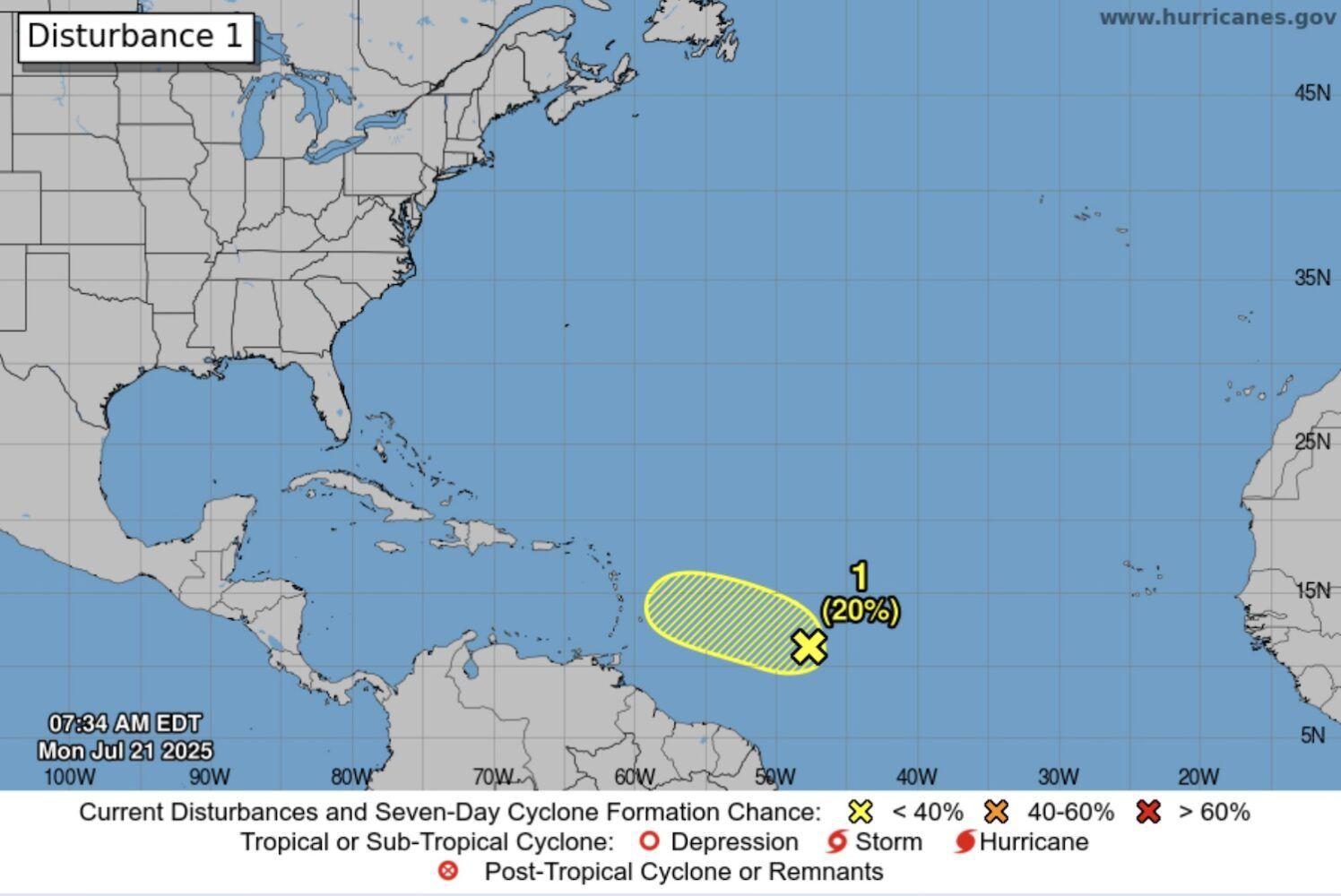
A disturbance in the Atlantic that is slowly moving west towards the Caribbean has a low chance of forming a tropical depression over the next week, according to storm experts.
The US National Hurricane Center (NHC) has predicted just a 20% chance of the weather system becoming a weak cyclone over both the next 48 hours and seven days.
According to a NHC forecast on 21 July, at 8am the area of low pressure was located at about 700 miles east-southeast of the Lesser Antilles – the eastern most islands of the Caribbean.
Showers and thunderstorms associated with the disturbance had changed little in organisation over the previous several hours.
“Environmental conditions are marginally conducive, and any development should be slow to occur while the system moves generally west-northwest at 10 to 15 miles per hour,” the forecast said.
It added that in a couple of days, conditions are forecast to become unfavourable for further development.
Current projections show the weather system passing just south of Anguilla.
In May, the National Oceanic and Atmospheric Administration (NOAA) forecast increased storm risk this Atlantic hurricane season from June to November.
It predicted between 13 and 19 named cyclones with winds of 39 miles per hour or higher, with six to 10 forecast to become hurricanes with winds of 74 mph or higher.
Of those, the agency is expecting three to five to be major hurricanes, of category three, four or five, with winds of 111 mph or higher.
Information on how to prepare for a hurricane is available from the US National Weather Service here.
Visit the US National Hurricane Center for the latest cyclone updates at nhc.noaa.gov