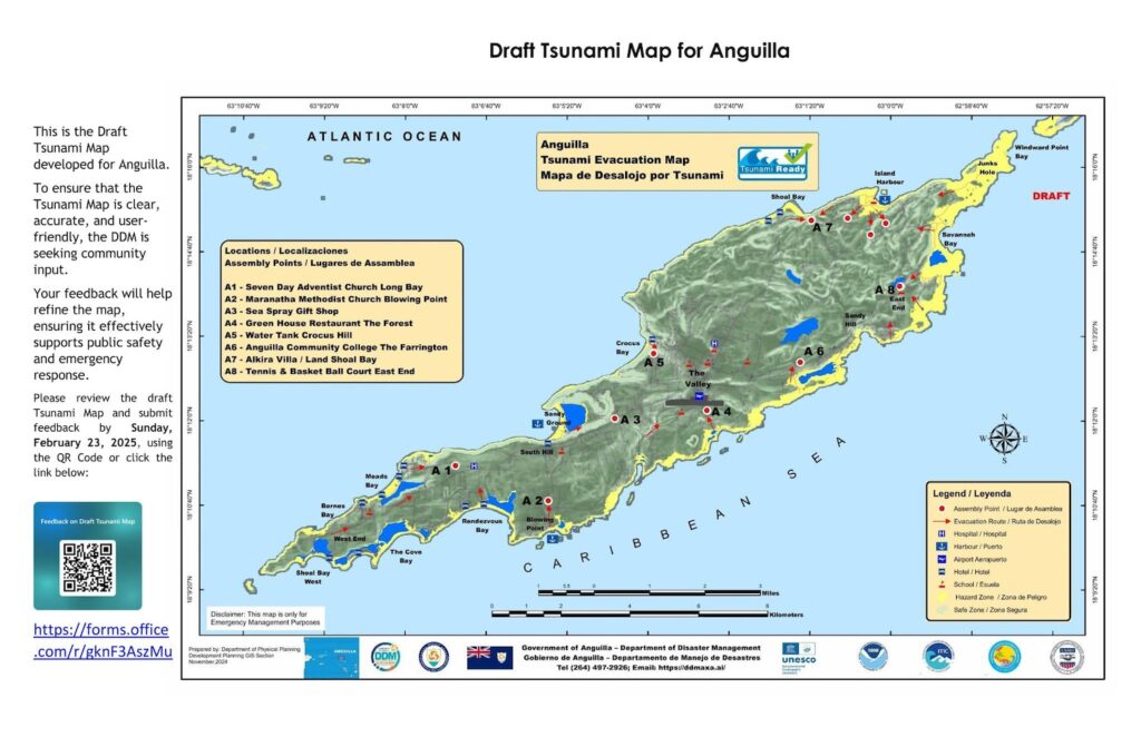
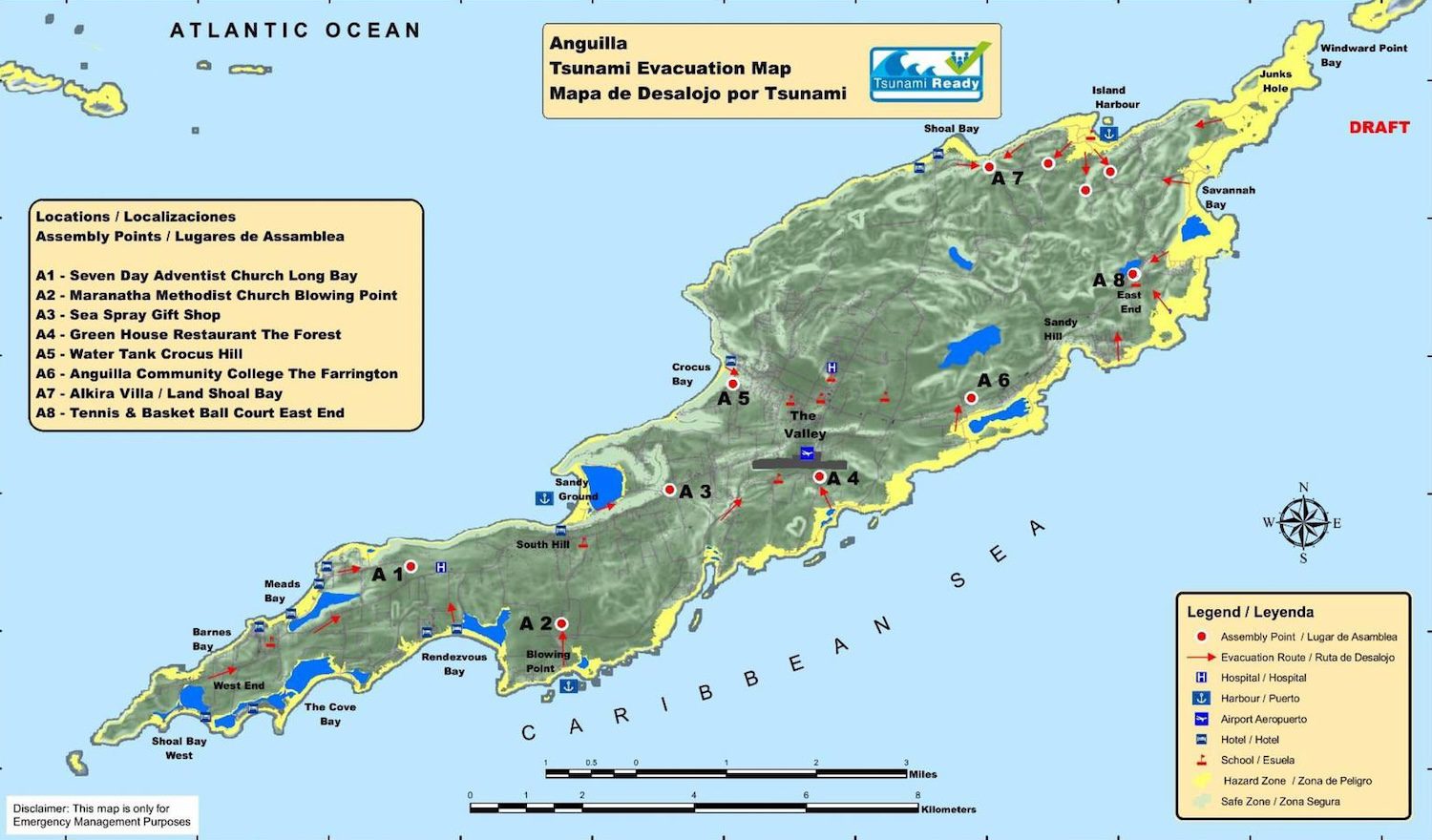
The Department of Disaster Management is inviting residents, businesses and stakeholders to provide their feedback on a draft tsunami map of Anguilla.
The map highlights critical evacuation zones and designated assembly points to help residents respond effectively in the event of a tsunami.
It was created as part of the TsunamiReady Programme, launched in March 2024 to enhance preparedness for tsunami threats through hazard mapping, public education and emergency planning.
A Department of Disaster Management press release on 13 February explained that the mapping is important as tsunamis rank as the third most significant natural hazard for Anguilla.
The recent magnitude 7.6 earthquake north of Honduras on 8 February, which briefly triggered a regional tsunami advisory, served as a strong reminder of the need for preparedness, it added.
Public input
To ensure that the tsunami map is clear, accurate and user-friendly, the Department of Disaster Management is seeking community input.
Feedback will help identify any necessary improvements to refine the map, ensuring it effectively supports public safety and emergency response.
The public consultation period runs for ten days until 23 February, and feedback can be provided:
- Online: Access the feedback form via the DDM Facebook page
- Email: Comments can be sent to ddm@gov.ai
“Your input is invaluable in strengthening Anguilla’s tsunami preparedness. Take this opportunity to help shape a safer future for our island community,” the press release said.
View the map in full below: