9 September, 1pm:
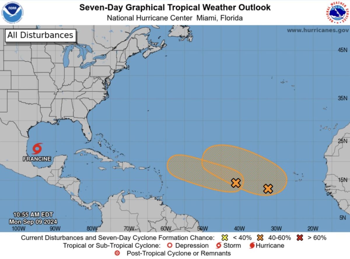
An area of low pressure in the central tropical Atlantic has a 60% chance of developing into a weak cyclone within the next 48 hours.
Forecasters from the National Hurricane Center said in their 8am update that environmental conditions are “marginally conducive” for development during the next few days.
The weather system is currently producing disorganised showers and thunderstorms, and a tropical depression could form while the system moves west-northwest at about 10 mph.
On its current path, the storm is likely to pass north of Anguilla.
A second trough of low pressure in the Atlantic, which has a 60% chance of forming a cyclone within a week and no chance in 48 hours, is likely to pass north of the Caribbean.
Anguilla’s Department of Disaster Management has not yet commented on the current weather systems.
Above average
In May, the National Oceanic and Atmospheric Administration predicted an above normal Atlantic hurricane season. This takes place from June 1 to November 30.
Experts forecast a range of 17 to 25 total named storms with winds of 39 miles per hour or higher. They expected eight to 13 to become hurricanes, with winds of 74 miles per hour or higher.
Of those, they forecast four to seven to be major hurricanes, of category three, four or five, with winds of 111 miles per hour or higher.
The only hurricane to hit Caribbean islands so far this season was Hurricane Beryl, which is the earliest Category 5 Atlantic hurricane on record and the second recorded in July.
Information on how to prepare for a hurricane is available from the US National Weather Service here.
Visit the US National Hurricane Center for the latest weather updates at www.nhc.noaa.gov


