
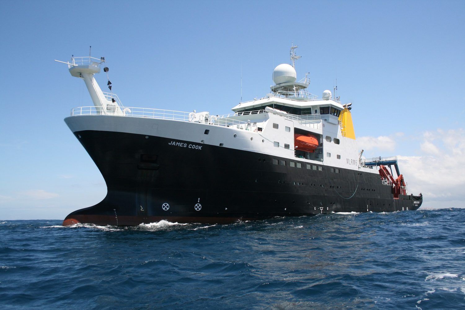
A team of 46 marine scientists will set sail aboard the deep sea research vessel RRS James Cook in January to study Anguilla’s previously uncharted waters.
It will be the first expedition to the Caribbean in the 10-year history of the Blue Belt Programme – a United Kingdom-led initiative to protect and manage the overseas territories’ marine environments.
The ship will set off from the Dominican Republic, stopping first in Anguilla before sailing on to the Turks and Caicos Islands and the Cayman Islands over the course of six weeks.
We’re not owned by shareholders or wealthy investors. Members help fund our independent work. Click here to join Anguilla Focus from $3/month.
Collectively, these territories steward 365,000 km2 of ocean – an area one and a half times the size of the UK, the UK government said in a press release on 13 November.
The Beyond the Reef Caribbean expedition will collect data on offshore ecosystems to help the governments make decisions on sustainable marine management and blue economy opportunities.
Eighteen scientists and marine managers from the governments of Anguilla, the TCI and the Cayman Islands will join 28 UK scientists.
They are from Cefas, the Marine Management Organisation, the National Oceanography Centre, the UK Hydrographic Office, the Natural History Museum and the British Antarctic Survey.
Anguilla will be represented by five scientists, contributing expertise in local fisheries, the environmental impacts of human activities and a detailed knowledge of local ports.
Demystifying the deep
While Anguilla, the TCI and the Cayman Islands are well known for their thriving coral reefs and pristine beaches, much of the scientific research to date has focused on their coastal waters.
The deeper offshore regions, by contrast, remain largely uncharted due to the challenges of access, the UK government said.
“As a result, the impact of human activities, climate change and pollution on these ecosystems is still poorly understood,” it added.
“Improving scientific understanding of these areas is key to developing effective strategies to manage and protect them.”
The expedition will study previously unexplored offshore areas to document unique species, assess human impacts and inform conservation strategies.
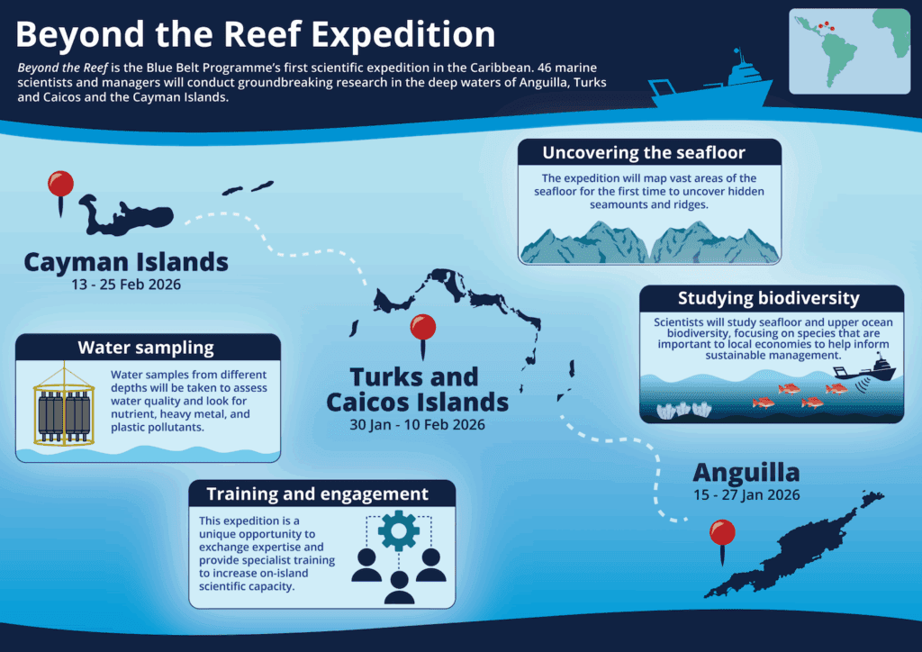
Scientists will create detailed seafloor maps to understand ecological hotspots, support sustainable fishing and improve navigational safety.
The team will track pollution and baseline ocean conditions to assess climate change impacts and protect critical habitats like coral reefs.
The expedition builds on previous Blue Belt Programme missions, advancing scientific exploration to safeguard millions of square kilometres of ocean ecosystems.
Learn more about the expedition here.
What a splash! Sending the RRS James Cook to Anguilla is like taking a detailed map of your backyard – you know the grass is green, but you’ve never actually charted the location of that one weird rock.
Definitely essential for sustainable fishing, though – you wouldn’t want to accidentally navigate onto someone else’s prime anchovy spot, would you?
The combined expertise sounds impressive, though I wonder if they’ll bring enough sun cream for the deep-sea scientists.
Fingers crossed the seafloor maps are clearer than my attempts at DIY plumbing!